VargGPS
Google Maps, Waze and offline maps alongside your Stark or VargPilot dashboard.
- Use Google Maps
- Use the Google Maps app already on your phone. Tap Varg App during navigation to return to your dashboard with a floating map.
- Waze, one tap away
- Tap Varg App in Waze, then Waze on your dashboard to switch back. Both buttons start at the top right in landscape. Waze stays full screen.
- Original Stark and VargPilot
- Choose your dashboard in VargGPS. Use floating maps or switch to Waze and back with the return button.
- Offline maps, tracks and recording
- Download a region, import a track or record your route. Follow your position without a destination.
Maps alongside your dashboard
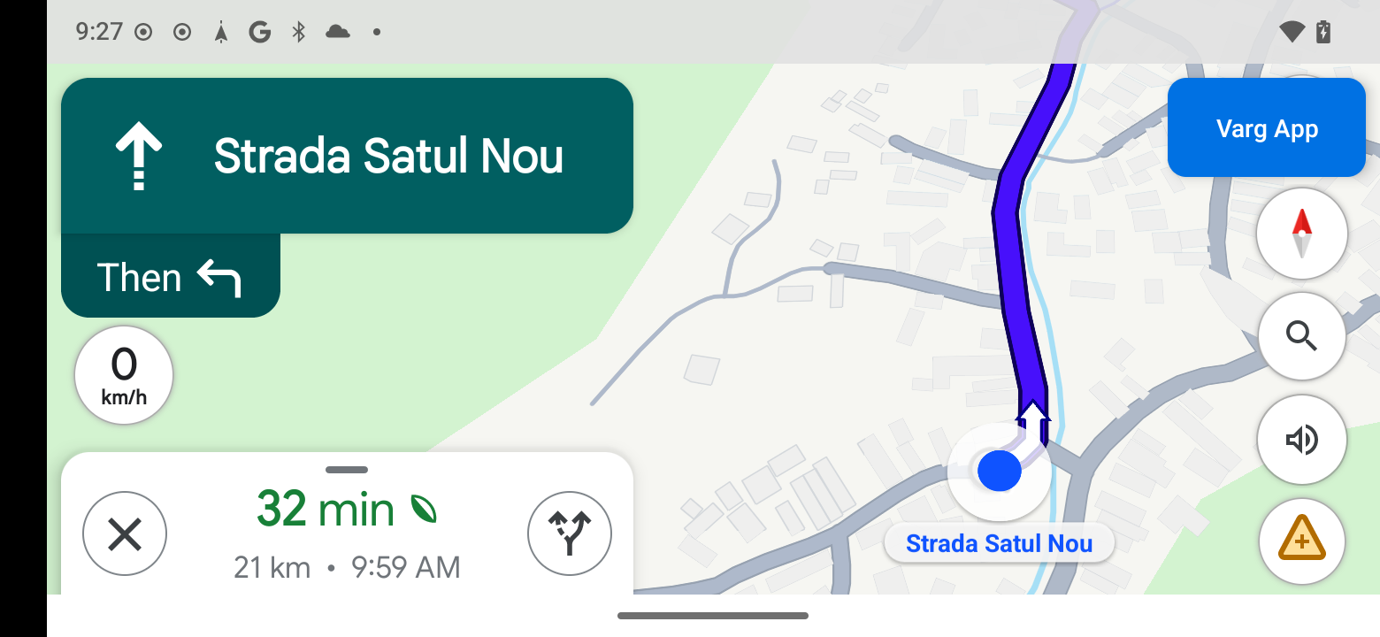
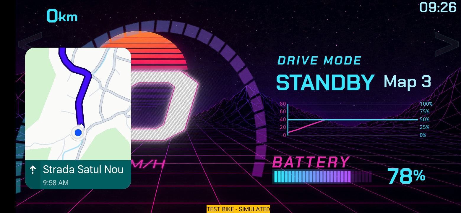
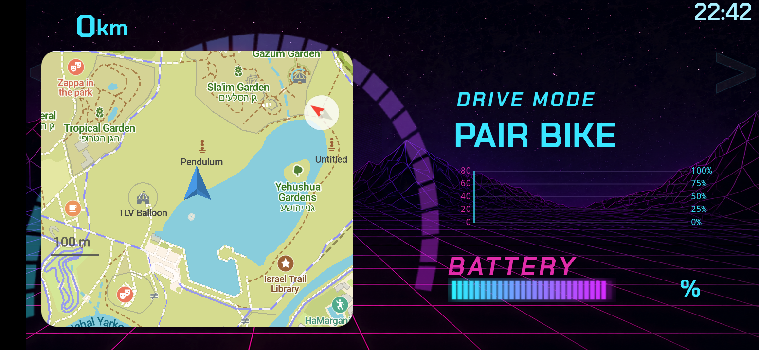
Tap a screenshot to view it full size. Google Maps PiP needs active navigation; the built-in map can follow you without a destination.
Installation
Step 1 of 4Use the browser on your Arkenstone. No computer, USB debugging or developer setup is needed.
1. Download the APK.
On your Arkenstone, tap Download APK below.
Download beta APKChrome says “File might be harmful”
This is Chrome’s general warning for APK downloads, not a Play Protect scan result. If you downloaded from this page, choose Download anyway.
I’m on another phone or computer
Open varggps.pages.dev on the Arkenstone and download there.
2. Open the downloaded file.
Open your browser’s Downloads and tap VargGPS-Beta.apk.
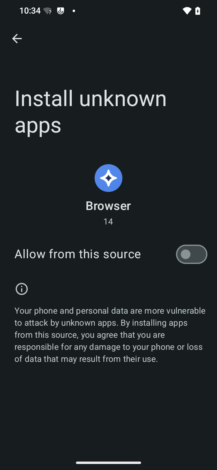
Android asks me to allow installation
Tap Settings → Allow from this source, then go back. This lets your browser install the APK; turn it off after installation.
I can’t find Downloads
In Chrome, open the three-dot menu and choose Downloads. Or open the Files app and choose Downloads.
3. Install and open VargGPS.
Tap Install, then Scan app if asked. When installation finishes, tap Open. The app appears as Varg GPS Test.
Android says “App not installed”
Check free storage and that your device supports ARM64. An existing version with a different signing key may also block installation. Export important tracks before changing installations.
Play Protect blocks installation
If a scan is offered, choose Scan app. If Play Protect still blocks the APK, stop and wait for an updated build. Keep protection enabled.
4. Download your map.
Download the overview map, then your riding region.
What should I allow in Ride setup?
Precise location: shows your position and records your route.
Picture-in-Picture: keeps the map floating over your dashboard.
Return to VargGPS after changing a setting. Google Maps and Waze setup is optional.
Then open your dashboard, or set up Google Maps or Waze.
Check the map over your dashboard while parked before using it on a ride.
Tap Next after completing each step on your device.
Open your dashboard
- On the map, tap Varg App.
- Choose Stock Stark or VargPilot.
- Move the floating map where you want it.
To return full screen, tap the floating map, then Expand. Try this while parked before riding.
Set up Google Maps
Once set up, the Varg App button appears automatically over Google Maps. Tap it to return to your chosen dashboard.
- Choose Navigation → Google Maps in VargGPS.
- In Display over other apps, select Varg GPS Test and allow it, then press Back. This shows the Varg App button.
- In Usage Access, select Varg GPS Test and allow it, then press Back. This shows the button only when needed.
- Allow location in Google Maps. If needed, open Settings → Apps → Maps → Picture-in-Picture, allow it, then return to Maps.
Double-tap the floating map to make it larger.
Try it while parked
- Start navigation in Google Maps.
- Tap Varg App (top right by default). The dashboard should open with a floating map.
- Tap the floating map, then Expand. The Varg App button should return.
Without active navigation, the button returns to your dashboard without a floating Google map. Use the built-in map to follow your position without a destination.
Set up Waze
Switch between full-screen Waze and your dashboard. This mode does not show a floating Waze map.
- Install and open Waze, then choose Navigation → Waze in VargGPS.
- Allow Display over other apps for Varg GPS Test to show the button, and Usage Access to show the right button for the app in front. Press Back after each setting. If already allowed for Google Maps, no extra setup is needed.
- In Waze, tap Varg App. On your dashboard, tap Waze to switch back. Both start at the top right. Try both directions while parked.
No auto-enlarge helper or Accessibility access is needed for Waze.
A few details
Move the buttons
Hold and drag a button to move it. Its position is saved separately for Google Maps, Waze and each dashboard app. Buttons start at the top right until you move them.
Optional: automatic enlargement
A separate helper can enlarge Google’s floating map on Android 12 or newer. Installation may be blocked on some devices. If blocked, use manual resizing: double-tap the floating map. The main app works without the helper.
- If helper installation is allowed on your device, open Menu → Google Maps options → Auto-enlarge Google Maps → Download helper.
- Install the helper, then return to VargGPS and reopen Auto-enlarge Google Maps.
- In Android Accessibility, enable VargGPS Auto-enlarge and confirm. This lets it identify Google’s floating window and send a double-tap.
- Press Back to return to VargGPS and check that the helper is enabled.
If Android shows Restricted setting, open the helper’s App info → ⋮ → Allow restricted settings, if available, then retry. Only allow this for a helper you trust.
If blocked, keep Play Protect enabled and use manual resizing. The helper’s Accessibility setup is optional and separate from the main app.
Beta build and updates
This beta uses a development signing key, not a dedicated production signing identity. A future release may need a separate installation, so export important tracks before changing builds.
Map regions download in the app. There is no bike telemetry or Bluetooth integration.
Beta build 26092503 · Release details and checksum